
The Olympic National Park Traverse(ONPT) is a 104.5 mile self created route that patches together many of the most remote and difficult trails in Olympic National Park. From June 24th-28th, 2018 I solo hiked this self-created route. With 256ft average elevation gain per mile and no resupply points, this trip was one of the most difficult but beautiful I have enjoyed to date!
Whats on this page:
Why the ONPT
Videos
Route
Unique Challenges
Why the Olympic National Park Traverse
The ONPT was my first foray into planning a hike without prebuilt guides or comprehensive resources. I wanted to plan a challenging route through the Olympics for one primary reason, to make the most of my time in Washington before starting my PCT thruhike. It was another opportunity to ensure my gear and my fitness levels were ready for a thruhike.
This hike, like my others gave me opportunities to hone my skills in specific new ways, here is a non-comprehensive list:
Route Creation - I had not yet planned a hike that I put together, mapped out, took its profile, and marked waypoints, etc.
Snow Travel - Building on my experience on the Tahoe Rim Trail, I wanted to continue to grow my comfort level of hiking in the snow.
Videos
Over the course of the trip I took quite a bit of footage and put it together as a two part video series. These were my first videos and I learned a lot in the process, the video quality will grow with my experience. I hope you enjoy!


Route
I broke my route on the ONPT up into five different sections:
Sect 1:
Begin: Graves Creek Trailhead
End: West Fork & Main Dosewallips River Junction
Length: 25.6 miles
Gross Elevation Gain: 7776ft
My route started in the southeast portion of the park at the Graves Creek Trailhead. It follows the Quinault and West fork of the the Dosewallips River. This section took me through Enchanted Valley, a popular backpacking destination. Followed by a climb over Anderson pass before following the West fork of the the Dosewallips River.
Sect 2:
Begin: West Fork & Main Dosewallips River Junction
End: Obstruction Point Road Junction
Length: 24.1 miles
Gross Elevation Gain: 9700ft
This section contained some gnarly elevation gain and some very difficult passes but promised to be some of the most beautiful miles on the trail! After following the Dosewallips River climbed the primitive trail over Lost Pass, Cameron Pass and Grand Pass before entering Grand Valley. The section concludes after the climb upwards to Obstruction Point Road.
Sect 3:
Begin: Obstruction Point Road Junction
End: Appleton Pass Trailhead
Length: 22.5 miles
Gross Elevation Gain: 3579ft
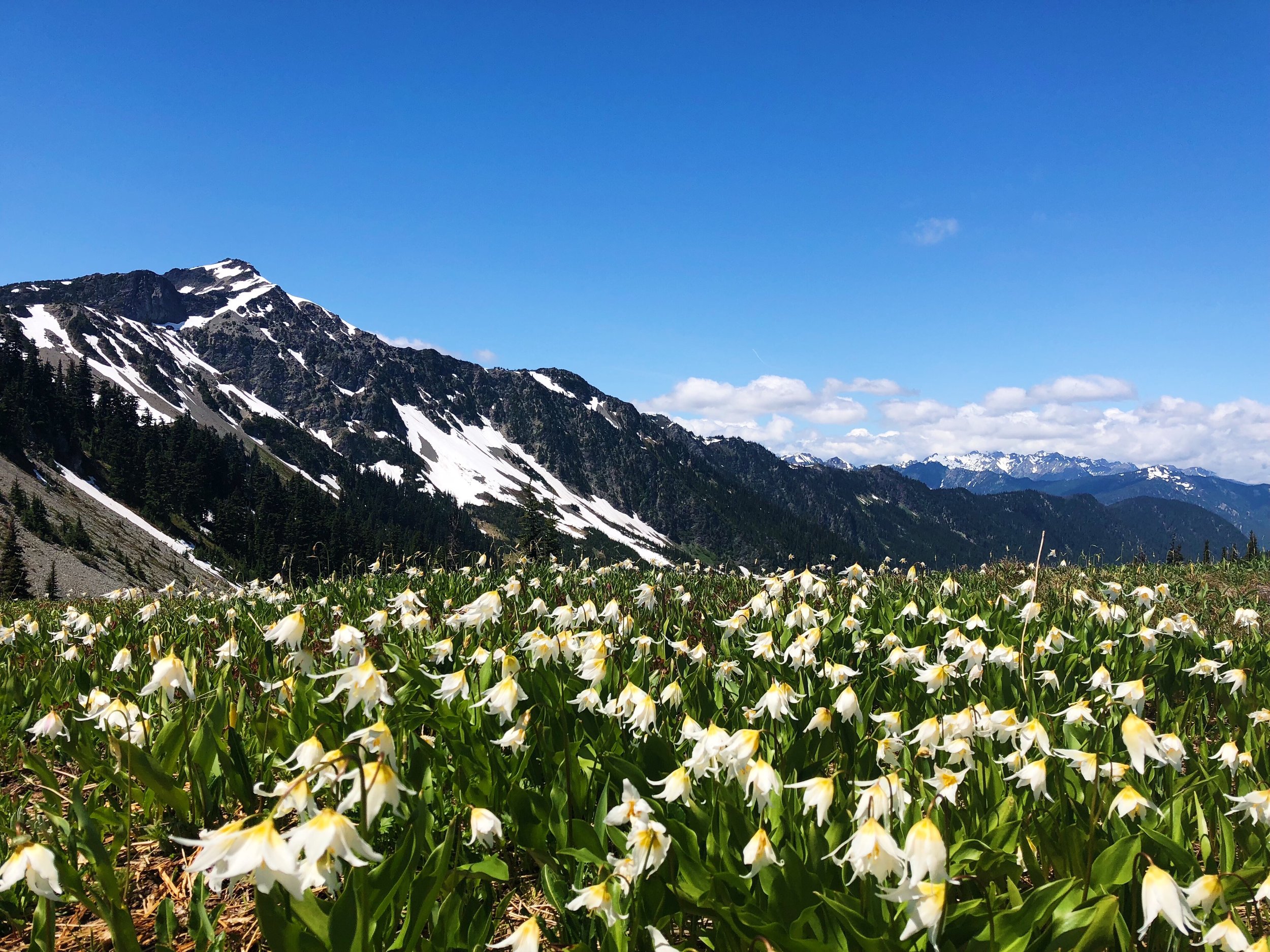
This section starts as a road walk down to Hurricane Ridge Visitor Center. It then follows the ridge past Hurricane Hill and descends into Altair before heading back to trail toward Appleton Pass. This section is primarily downhill and had some of the magnificent views as I hiked along the Hurricane Ridge. It was a welcome reward for the previous sections difficult hiking.
Sect 4:
Begin: Appleton Pass Trailhead
End: Hoh River Trail Junction
Length: 20.1 miles
Gross Elevation Gain: 5502ft
This section took me up over Appleton Pass and then along the ridge line enjoying a few glimpses of Mt. Olympus and the Bailey Range through a foggy morning.
Sect 5:
Begin: Hoh River Trail Junction
End: Hoh Rain Forest Visitor Center
Length: 9.5 miles
Gross Elevation Gain: 1193ft
This section was originally going to lead up to Glacier Meadows and then double back down to the visitor center but with time and permit restrictions I was not able to swing it. So this section is simply a walk along the Hoh River, the largest river I will follow, to the terminus of my route at the Hoh River Visitor Center.
Here is a map of the complete route. Open it in CalTopo for a better view!
Unique Challenges
I always try to be humble in the face of nature and its might. Here are some of the things I expected to be uniquely difficult on this hike.
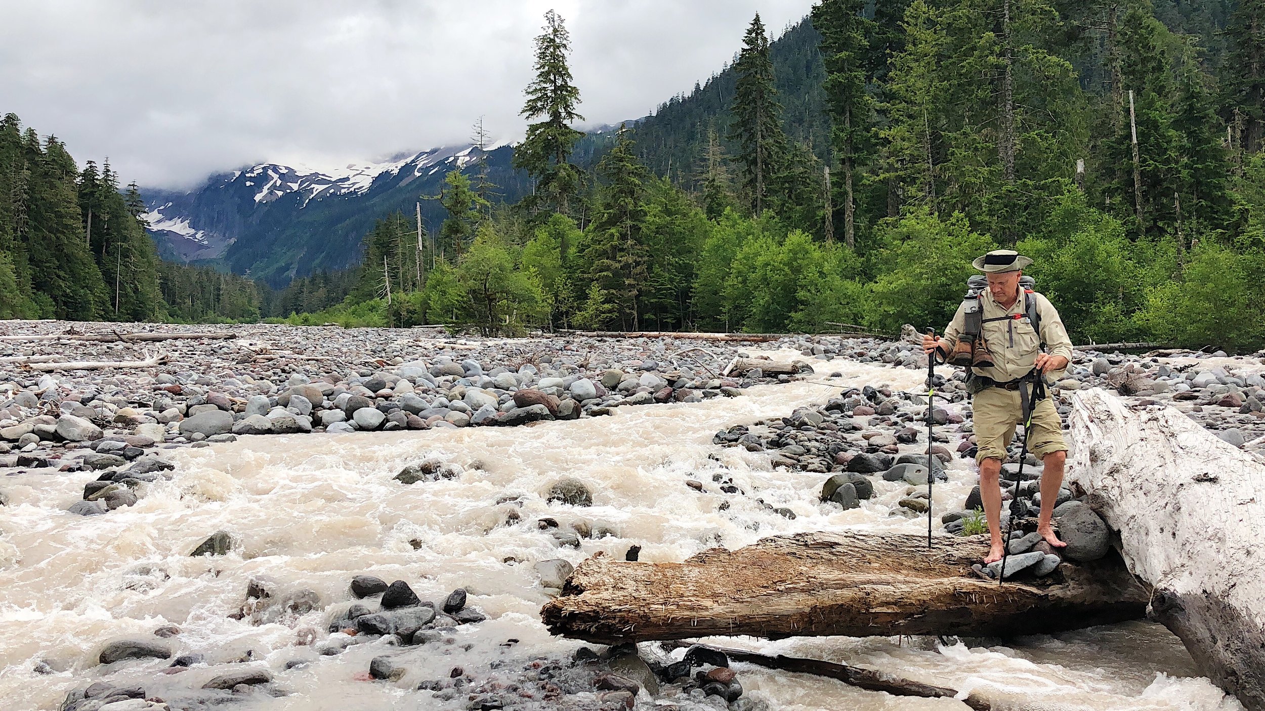
Elevation Gain - Olympic National Park is know for its rocky summits simply jumping out of the ocean. These mountains are nothing like back in Virginia. They climb quickly at relentlessly steep angles. In particular, Lost Pass, Cameron Pass, and Grand Pass, were very difficult with steep, snowy accents. Luckily I was climbing their southern faces, meaning less snow on the way up, but more on the way down.
Base Weight - I like the challenge of a difficult hike, but I also want to be as prepared as possible. On this hike I brough my microspikes(13oz) and an ice axe(9oz). Since the weather right before leaving took turn for the colder I also packed some tights for sleeping in(6oz). In addition to this extra weight in my pack, I also packed all five days of my food for the trip because there were no resupply opportunities in the park.
Solo - I took on this trip alone, raising the stakes significantly. I hadn’t taken a solo trip in over a year, and this one was far more rugged.